Gallery: Maps
To enlarge, click Ctrl and '+'. To restore, click Ctrl and '0' (zero).
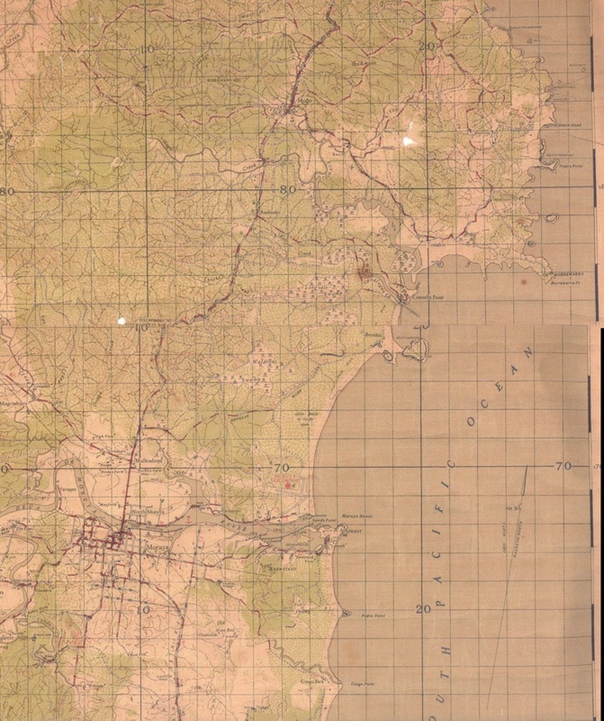
1942 Map Malua Bay to Moruya. RF.
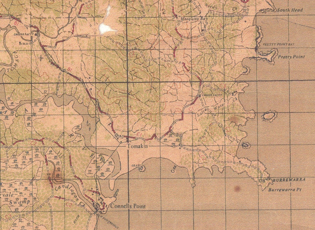
1942 Map Burrewarra Point to Connells Point. RF.
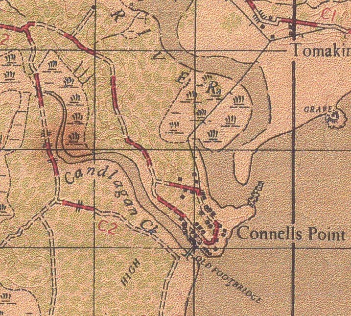
1942 Map of Connells Point. RF.
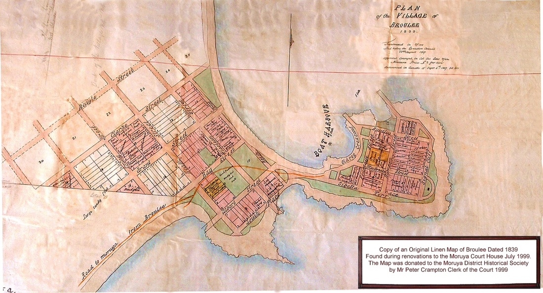
Linen Map of Broulee Dated 1839. Photo Moruya District Historical Society.
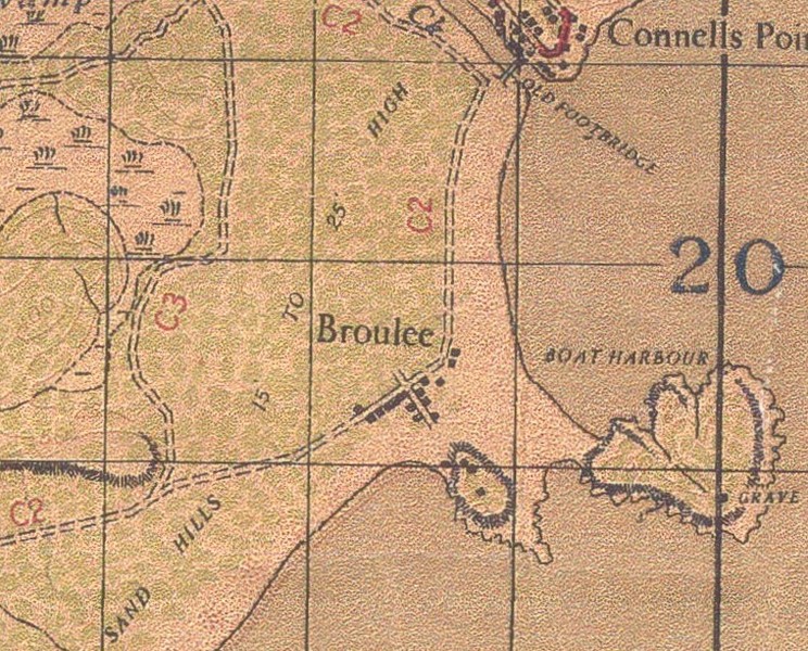
1942 Map of Broulee. RF.
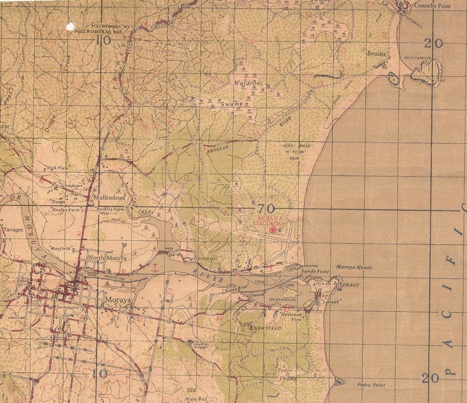
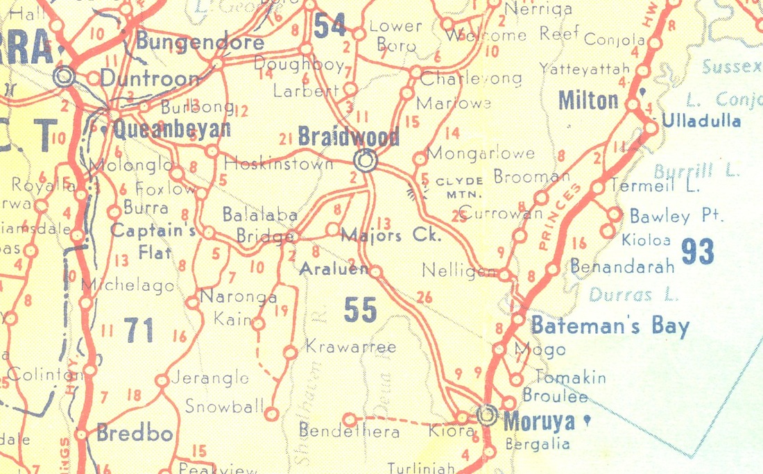
1942 Map of Broulee and Moruya. RF.
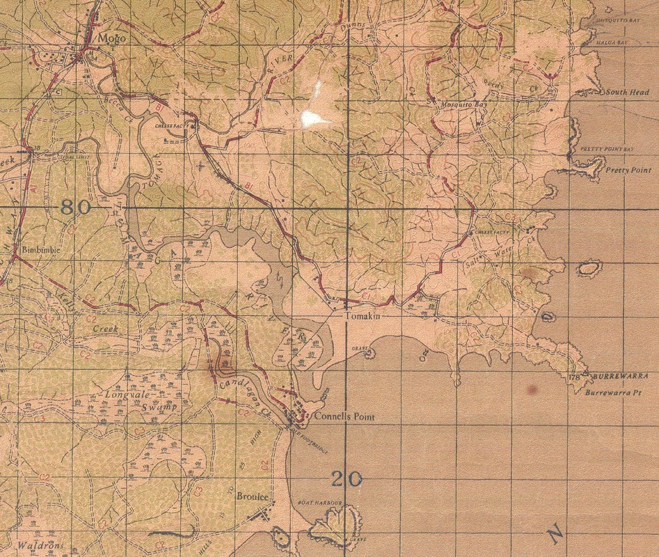
1942 Map showing Mogo also. RF
For the 1942 map, roads were categorised as follows:
A. Sufficient width for 2 traffic streams.
B. Sufficient width for 1 traffic stream with occasional passing.
C. Sufficient width for 1 traffic stream only
1. Suitable for heavy motor transport.
2. Suitable for light motor transport up to 3 ton lorries.
3. Suitable for horse transport only.
4. Suitable for pack only.
Shell Road Map c1950. Princes Highway was sealed, Kings Highway was not. RF.
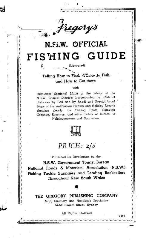
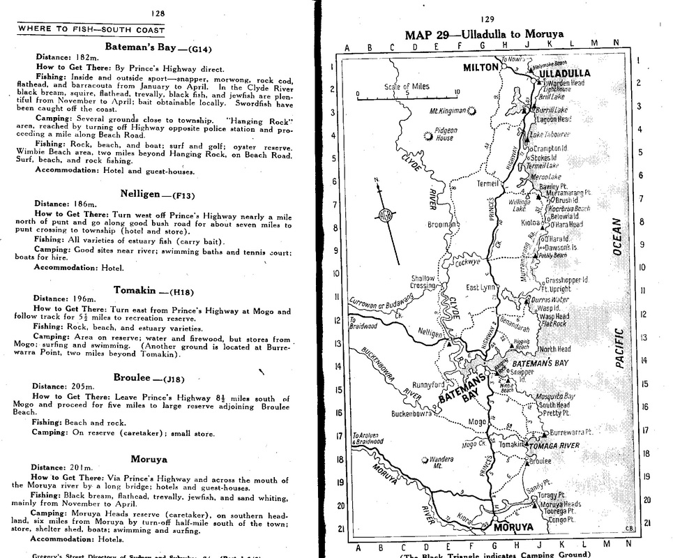
Gregorys Fishing Guide, 1930s or 1940s. RF.