The Mogo GoldField
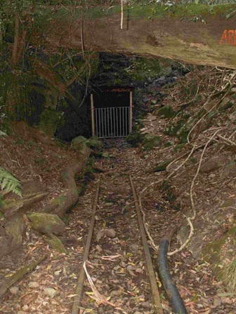
Kellys Creek Mine 2008. RF.
|
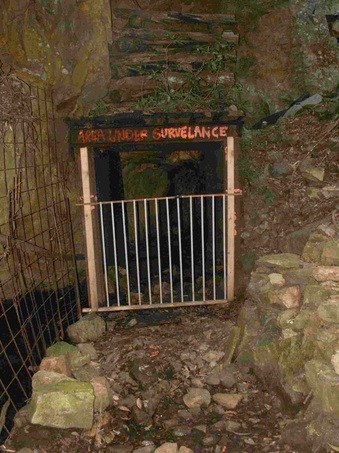
Kellys Creek Mine 2008, the entrance. RF.
|
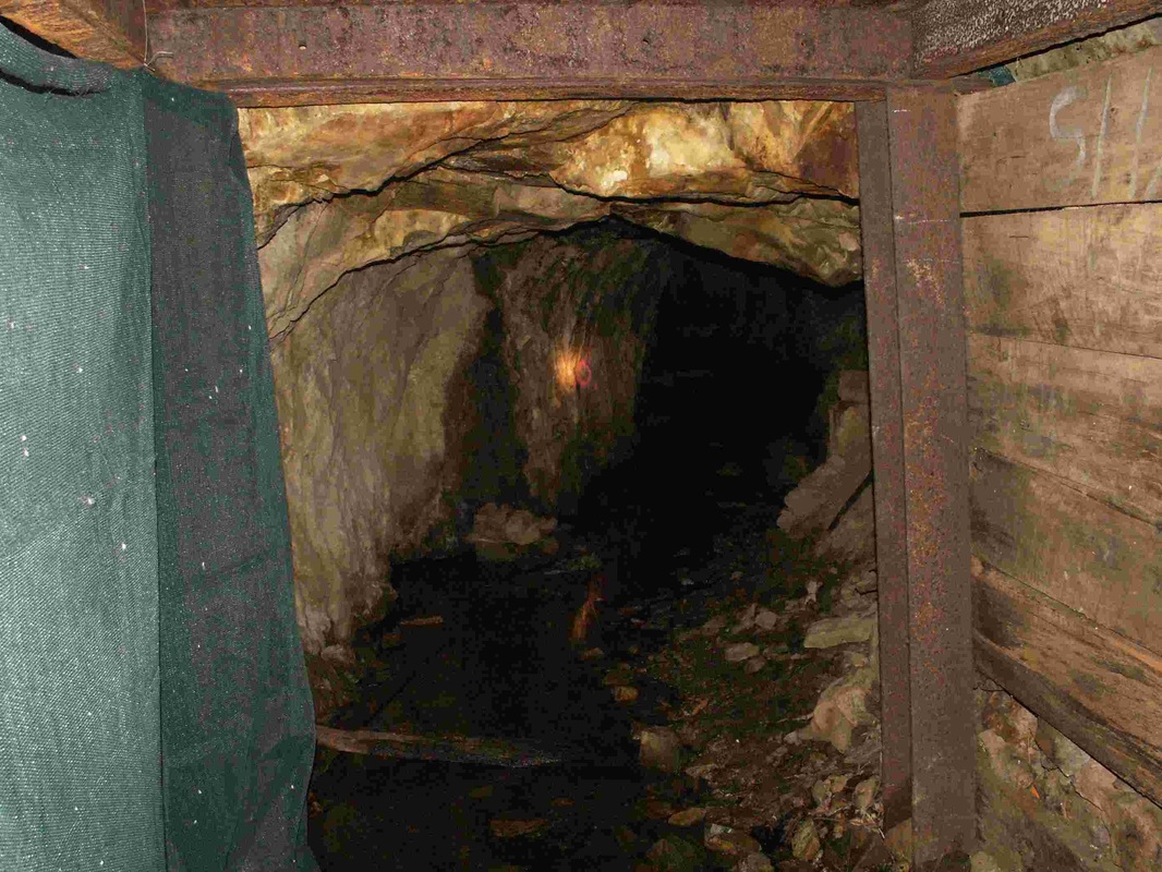
Kellys Creek Mine 2008, looking in. RF.
|
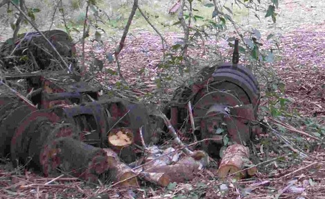
Kellys Creek Mine 2008, winching equipment. RF.
|
The first strikes in the Mogo Goldfield were in Jeremadra, soon there were strikes around what is now Mogo, extending South to Bimbimbie.
The Jeremadra and Mogo strikes were in the catchment of the Tomaga River.
The Kellys Creek Mine at Bimbimbie, is in the catchment of Candlagan Creek.
So that’s the Mogo Goldfield's relationship to Broulee, Mossy Point and Tomakin.
The Jeremadra and Mogo strikes were in the catchment of the Tomaga River.
The Kellys Creek Mine at Bimbimbie, is in the catchment of Candlagan Creek.
So that’s the Mogo Goldfield's relationship to Broulee, Mossy Point and Tomakin.
In 1851 gold was discovered on the Deua River, near what was called the Head of Navigation, it’s where Kiora is today. Soon gold was found along 50km of the river, up to Araluen. Araluen was big, in its prime it had 15,000 people there. There were hotels with their own bands, and dancing girls had been brought down from Sydney Town. Most of the diggers had traveled by sailing ship to Broulee, then walked the remaining sixty or so kilometres. You could hire packhorses at Mullenderree for 25/- for 100lb of luggage, but 25/- was a lot in those days, farm workers only got about 30/- a week.
In 1857 what was called the Broulee diggings were opened, in fact this was the field around Goldfields Drive, off the Old Mossy Point Road. It attracted 20 or 30 diggers, but in a few months it was deserted. However the following year, 1858, a new rush broke out with the discovery of gold at Cabbage Tree Creek just out the back of Mogo. Cabbage Tree Creek flows into Mogo Creek which flows into the Tomaga River.
In the middle of 1858 there were 200 diggers there. The field had mixed success for decades, and Mogo Post Office was opened in 1869 with George Veitch as the first Postmaster.
After the first strike in 1857, the Mogo fields were worked on and off for quite a few years. In 1886, the Moruya Examiner reported that ‘Mogo maintains a number of diggers but the ground is patchy.’ Nevertheless, work went on in one form or another for over 100 years, until 1984.
As well as gold diggers, there were bushrangers. In 1873 James Veitch, who took over the Mogo Post Office from his widowed mother’s next husband Frederick Ladmore, had been to Moruya selling gold. He was crossing the bridge at Jeremadra Creek when he was bailed up by two men who demanded "Your money or your life!" Veitch spurred his horse and one of the bushrangers fired on him, the bullet went through his coat. Pretty lucky.
The Mogo Goldfield was on both sides of the Princes Highway, it started about 5km north with what were called the Big Hill Workings near Mogo. By 1936 it went as far south as Pollwombra, a couple of kilometres inland from the Broulee turnoff.
This next part comes from a report written in 1879 by Lamont Young, a Government Geological Surveyor. That’s 22 years after the first Mogo rush, and six years after James Veitch was bailed up by the bushrangers. In that particular year, 1879, there was little or no mining being done in the Mogo locality, and the township was nearly deserted.
Just as an aside, if the name ‘Lamont Young’ sounds familiar, he was the Government man who a year later, 1880, hired four men and a boat at Batemans Bay to take him down to the new Montreal gold strike at Wallaga Lake. After he’d been there, they went off in the boat again, it was subsequently found deserted, no trace of the men was ever found, and that’s the mystery that gave Mystery Bay just near Narooma its name.
But back to Mogo. There was gold a little over a kilometre and a half to the north of the township, these were claims worked by Burn, Combe and Corrigan. The Cabbage Tree Creek claim was Pickett’s, and a bit further north there was Tucker Hill, later on in 1898 a miner named Bellette took 1.24kg of gold from it. In today’s terms, that’s $33,800 worth.
Annetts’ and Degan’s claims were near the junction of Jeremadra Creek with the Tomaga River, and South of Mogo was a patch known locally as the ‘Poor House’, Lamont Young wrote: "it seems that when prospectors were hard up they could always wash out a few dwts there" [20 dwts to the ounce]. Lamont Young went on: "The creek, which passes through Mogo, is called Becca Creek on the east of the township [actually it was still called that on the 1942 map but we are too young to have heard it called that. It’s now known as Mogo Creek]. Attempts were made to work the alluvials in its vicinity, but the ground was found so highly charged with water that, after several parties had tried to get a shaft down, the locality was abandoned".
We have been told that in the mid 1980s a mining company with all the new gear took core samples from all over that area of floodplain between Mogo and the Zoo. They came up with absolutely no sign of gold, which they found astonishing considering all the gold that had been taken upstream.
South of Mogo was a claim known as Ryan’s Hill where Spedding and party spent, "a good deal of time and money’ putting in tunnels, making a tramway and dam and erecting a puddling machine, but it failed."
"King and party worked a reef between Buckenboura Road; and Maulbrooks Road." This area drains into Jeremadra Creek, which flows into the Tomaga River. Connell and party re-opened the old field along Goldfields Drive off the Old Mossy Point Road, that area too drains into the Tomaga River.
Almost 5km west-south-west of Mogo a reef close to Jeremadra Creek was worked by Marks and party. About 1 km to the South, The Shamrock Reef off Maulbrooks Road was worked by Lewis and Strong. It yielded 11.8kg of gold – about $250,000 at today’s prices.
The Bimbimbie gold was further South again, off Bimbimbie Road. There was the Bimbimbie Mine, Sandy Creek Mine, the Perseverance Mine and the shaft sunk by Holmes and party. The main workings included shafts up to 11.5m deep, with drives and adits up to 730m and an unrecorded amount of stoping, or working face. Officially, these workings produced about 198.5kg of gold, that’s about $M5.4 worth at today’s prices! That's where Kellys Creek Mine is.
All the creeks in the Bimbimbie area are joined to Candlagan Creek.
Flanagans or Green Range Reef is the one on Pollwombra Mountain. It had shafts up to 7m deep, and that’s the southern end of the Mogo goldfield.
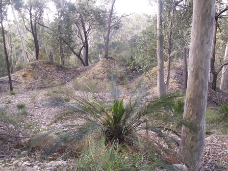
Bimbimbie Mullock Heaps 2008. RF.
|
But how about the life of the diggers in the 1800s? There are still mullock heaps and the old shafts out at Bimbimbie. Stand there and try to imagine what it would be like to live there in an old canvas tent without a floor in it, in the mud after about a week’s rain, and all the wood for the cooking fire sodden. No wonder that there was a well-worn path to the Rum Shanties at Mogo! |
